Foremost among the flood control works is the 3,500-mile MR&T levee system. The levee system, constructed of compacted soil and clay, rivals in length the Great Wall of China. 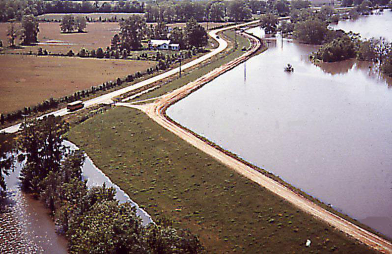
Mississippi River and Tributaries' (MR&T) levees currently protect more than 4 million citizens, 1.5 million homes, 33,000 farms, and countless vital transportation routes from destructive floods. The levees are designed to protect the alluvial valley against the project flood by confining flow to the leveed channel, except where it enters the natural backwater areas or is diverted purposely into the floodway areas.
The main stem levee system, comprised of levees, floodwalls, and various control structures, is 2,203 miles long. Some 1,607 miles lie along the Mississippi River itself and 596 miles lie along the south banks of the Arkansas and Red rivers and in the Atchafalaya Basin.
The levees are constructed by the Federal Government and are maintained by local interests, except for government assistance as necessary during major floods. Periodic inspections of maintenance are made by personnel from the U.S. Army Corps of Engineers and from local levee and drainage districts as it is essential that the levees be maintained in good condition for their proper functioning in the flood control plan.
The Mississippi Valley Division performed National Flood Insurance Program (NFIP) Levee System Evaluations (formerly referred to as certifications) for all MR&T levee systems between 2010 and 2012. The levee system evaluations were performed in accordance with EC 1110-2-6067, which provides evaluation guidance to ensure that the complete levee system may be considered as providing flood risk reduction during the base flood or 1% annual chance exceedance event (100-year event). A summary of levee system evaluation reports performed for the MR&T levee systems may be found in the report at the following link:
An NFIP levee system evaluation determination by USACE is a technical finding that, there is, or is not, a reasonable certainty that the levee system will reduce flood risk from the 1% annual chance exceedance event. If the levee meets NFIP levee system evaluation requirements, USACE makes a “positive finding,” recommending that the levee system be accredited by the Federal Emergency Management Agency (FEMA). If the levee does not meet NFIP levee system evaluation requirements, USACE makes a “negative finding” and the area behind the levee that is subject to the base flood could be mapped as a high risk area (or Special Flood Hazard Area) on FEMA Flood Insurance Rate Maps. NFIP levee system evaluation findings for the MR&T project levees are provided at the links below.